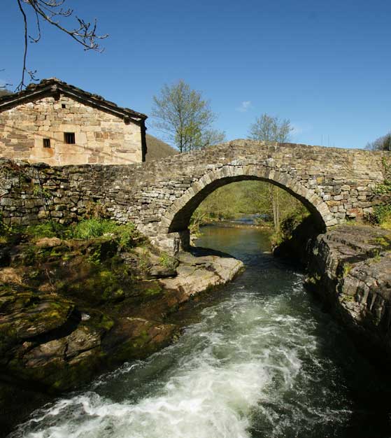
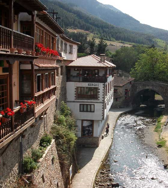
And the monument to the violinist Jesús de Monasterio who was born in the village. The rest of the village is best seen by walking around its many narrow back streets and exploring. The Old Quarter was damaged during the Civil War of 1936-39 but still conserves its medieval flavour. The name is said to come from the Latin “ Pontes “ meaning bridges and the bridges do indeed form an attractive part of the village.
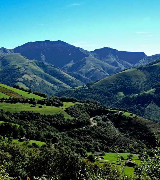
This is the name given to the valleys around that of the River Pas. We follow that of the River Miera,almost from its source down to the Bay of Santander. This is a glacial valley formed by a glacier during the last ice age, some 90,000 – 10,000 years ago. The glacial morains can be seen in the valley base. The valley was subsequently eroded to its present day state by the Miers and its tributaries.
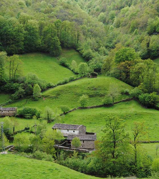
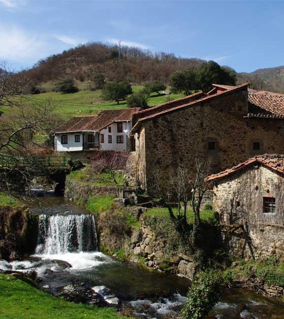
The cabaña pasiega was a stone hut built both as a residence and also to lodge the livestock. It seems to have originated in the late 17th / early 18th century when the pasiegos began to penetrate into these valleys from the north of the province of Burgos, just to the south of Cantabria. The construction is normally rectangular with a sloping roof made of slate. The entrance is to the south, and often the roof is extended to cover this and form a small corral for le sser livestock. The ground floor os often partly subterranean and is used for the cattle. Acces to the upper floor is by an external stone staircase. This floor is divided into two sections: one for the kitchen and living quarters and the other use as a hayloft. Heat emanating from the cattle raises the temperature of the upper floor. There are very few windows and these are very small. This living area would be both kitchen and communal bedroom.
The villages are very disperse, although the main winter huts are often grouped together and form sub-villages. More than 6000 of these huts still exist, although many have fallen into ruin. San Roque de Riomiera has around 900.Many are now being bought by tourists. The three main pasiego villages are Vega de Pas, San Pedro del Romeral and San Roque de Riomiera – their combined population is around 3000.
The area is characterised by its mountainous nature. The Pasiego system of cattle farming seems to have emerged from 15th – 18th centuries and is based on optimising the production of milk with a high fat content; this means that secondary products such as cheese are also of high quality. This method involves continuously moving the cattle around. The territory is divided into “ ranches”, each with a walled pasture and a stone hut. Each family owns an average of six of these ranches, although they may have even ten or twelve, distributed between lower and higher parts of the valley. Many have no electricity, running water, heating, ot telephone ( mobile phones may also have no signal). These huts have no bathroom and running water may be linited to an outside tap. When spring arrives, the household is transferred to the first mountain hut. As the season progresses, the family moves from hut to hut, ascending the valley and then descends again in autumn to the main hut in the valley for the next winter . Many of these huts are steep hillsides which means that machinery is often useless and grass must be cut by scythe and the pastures manured by had. During the summer months, the pastures in the valley are harvested to store hay for the coming winter. This movement affected the whole family, the cattle and their belongings. A horse or a mule would be usedto carry the belongings and other animals such a sheep, goats, a pig, hens would be taken to guarantee a more varied diet. Each family may have around 5-20 cattle and they may be moved around up to 30 times a yera. Tha school bus will often pick up the same children at differents stops as they move from hut to hut. These children may have to do their homework by lamplight and walk long distances to be able to catch the bus. Life was of course, simple and austere. Pasiego products were traded in the markets of Vega de pas, Selaya Villacarriedo, San Pedro del Romeral, Espinosa de los Monteros and San Roque de Riomiera. San Roque still has a small Sunday morning market. During the last few decades, this way of life has begun to disappear. Changes in agricultural policy, with the introduction of milk quotas by Brussels, have eroded the Pasiegos way of life and the strong identity of the Pasiegos built during centuries is now being lost. Many have now changed from dairy to meat producing cattle.
One interesting facet of the Pasiegos´life was that of the wet nurses, especially since the late 19th century.
Ice-cream was also produced and sold throughout Spain. One family became established in France and founded the Miko company.
In the 18th century, the upper part of the Miera Valley was slowly colonised by the Pasiegos for cattle farming. This area had been greatly deforested by the Real Fábrica de Cañones de La Cavada; thus the Pasiegos were able to build their huts here and establish pastures. The asymetrical aspect of the valley, with the eastern side being much steeper that the western side, meant that the latter was more intensely exploited.
The main huts, where the winters were spent, were built down in the lower reaches around the river, while the spring and summer huts were built higher up the valley sides.
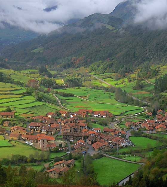
CARMONA – CANTABRIA
From Posada El Cuadrante we want to tell you that Carmona is one of the most emblematic and natives of the villages of Cantabria, in part because of its remote location. It is a typical example of mountain rural architecture. Many of the houses are decorated with coats of arms and balconies adorned with flowers.
The town’s largest building is the Palace of Mier (also known as the Palace of Rubin de Celis), an eighteenth century building on two stubby towers, each with three floors. Today it is known as the Venta de Carmona, a hotel owned by the local government.
The village has many other buildings of the seventeenth century. It is also possible to see local artisans make the albarcas to their doorsteps. The albarca is a typical highlander shoes and clogs are three legs that remain on the doors of houses and shoes with felt slippers inside and its function is to keep feet away from mud and moisture.
PICOS DE EUROPA – CANTABRIA
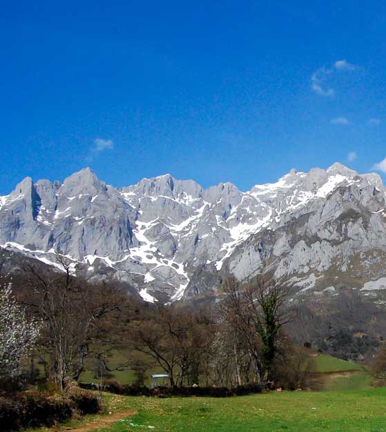
This is the name given to this beautiful mountain range which rises up to 2648 metres. ( 8688 feet ) to the highest peak Torrecerredo, just a short distance from the sea. Indeed, the visibility of the snow-capped peaks from the sea is said to be the origin of their name. Sailors returning from long voyages got their first glimpse of Europe here.
The mountains are divided into three massifs by the rivers Duje and Cares. The walk along the latter is an excellent opportunity to see the very heart of these mountains with very little effort. The names of the massifs are El Cornión – to the west of the Cares, Ándara which is on our right as we ride as we go from Unquera to Potes, and finally Los Urrieles which is the central and highest massif. We can ascend part of the central massif on the Fuente Dé cable car which takes us up to 1,800 metres. One of its most famous peaks is the Picu Urriellu, more popularly known as the Naranco de Bulnes
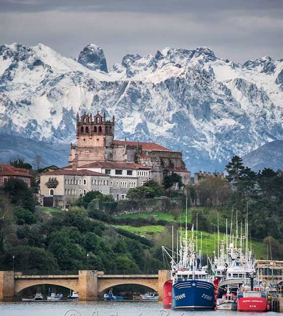
(2519 m / 8264 feet ). This vertically-walled peak has become a symbol of the Picos and is highly prized by mountaineers. It lies near Cabrales and on clear days is also visible from San Vicente de la Barquera.
The Picos are now a Parque Nacional whose administration depends on three comunidades autónomas – Cantabria, Asturias and Castilla-León. It is home to many protected species. It is common to see rebecos – a sort of chamois – along with eagles and vultures. Wolves and wild boar are also present, although not often seen by walkers.
Even more difficult to see is the bear which is still present in these parts. These animals tend to roam in the more remote reaches of the Picos and surrounding mountains, being more common to the west in Asturias.
LIÉRGANES
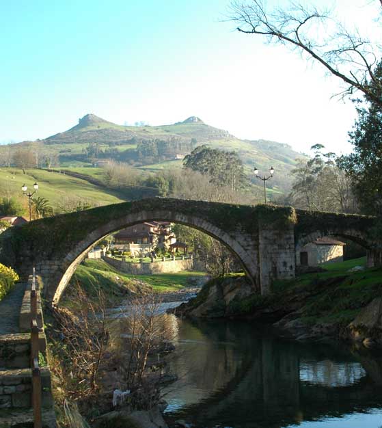
As we descend the Miera Valley, we reach the village of Liérganes. This village is divided into two sections;one is the old village with its pretty houses and squares, full of regional flavour; the other is the more modern section along the river which has grown around the spa hotel. This hotel was built in the early 20th century to exploit the sulphurous waters www.aytolierganes.com . Other hotels and restaurants have grown around it. The original spa was opened in 1862.
Along with La Cavada, Liérganes became an important artillery and canno prodicing centre in 1622.
The Old Quarter has many fine buildings such as the 17th century Palacio de la Rañada ( actually on the approach from Rubalcaba to Liérganes ). The village also has a fine renaissance bridge, the Puente Mayor or Puente Romano over the river Miera. Nearby the village we see the two hills popularly known as the Tetas de Liérganes(breasts of Liérganes).
Liérganes is locally famous for the leyenda del hombre-pez , the Legend of the Fishman from 1658. Francisco de la Vega Casar was a native of the village of Liérganes who went to work to Bilbao as a carpenter. One day, he went for a swim in the river and never returned. Nine Years later, in Cadiz, Andalusia, some fishermen pulled in their nets and discovered a damp and cold man covered in scales. They took him to Cádiz where he was recognised by a Cantabria due to a distinctive birthmark. He had lost his speech, but admitted he was Francisco de la Vega Casar of Liérganes. From this time on, he was exploited as a curiosity. He would only eat raw fish. One day he slipped away and was never seen again.
LIÉBANA
Liébana is the name given to the valleys which nestle below the Picos de Europa on the northern side, the range of Peña Sagra to the east, and the cordillera Cantábrica to the south. These valleys are separated by smaller mountain divisions which are not as high as the surrounding mountains which almost completely cut the area off from the outside world. The only way out of liébana is over the mountain passes of San Glorio which takes us to the province of León, or Piedras Luengas which leads to Palencia. The river Deva cuts it way through the gorge of la Hermida but the road that leads to the coast was only bulit in the 19th century. Previously the inhabitants had to cross the mountains to get to the coast. The map on the following page shows the layout of the valleys which make up the area of Liébana. These valleys make excellent territory for exploration. Although the surroundings are very mountainous, the valleys tend to be fairly level until they reach a certain point, after which they begin to climb ( with the exception of course of the valley which leads up to potes after we ride the Gorge of la Hermida. The valley which leads up to the impressive rock amphitheatre and cable car at Fuente Dé is of course a dead end. The other valleys are filled with charming villages and scenery.
Due to their isolation from the Atlantic Coast, the lower reaches of the valleys enjoy a privileged Mediterranean climate, sheltered from the inclement weather by the sorrounding mountains. Here we find crops that are not really typical of Northern Spain such as vines, fruit, olive and cork trees
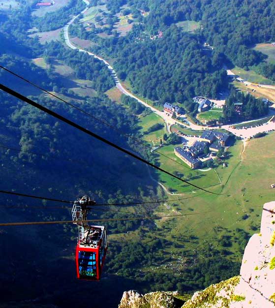
TELEFÉRICO DE FUENTE DÉ
An impressive rock amphitheatre and one of the biggest tourist attractions of Cantabria due to the cable car. This was erected in 1966 and takes 4 minutes to rise over 753 metres to gain incomparable views of the Picos and the surrounding mountains from a height of 1850 metres. From here we can ascend to the higher peaks with relative ease,although it must be remembered that this is high mountain country and can be dangerous if not treated with respect. Alternatively we can walk down to the village of Espinama through the pastures of Los Puertos de Áliva.
SAN VICENTE DE LA BARQUERA
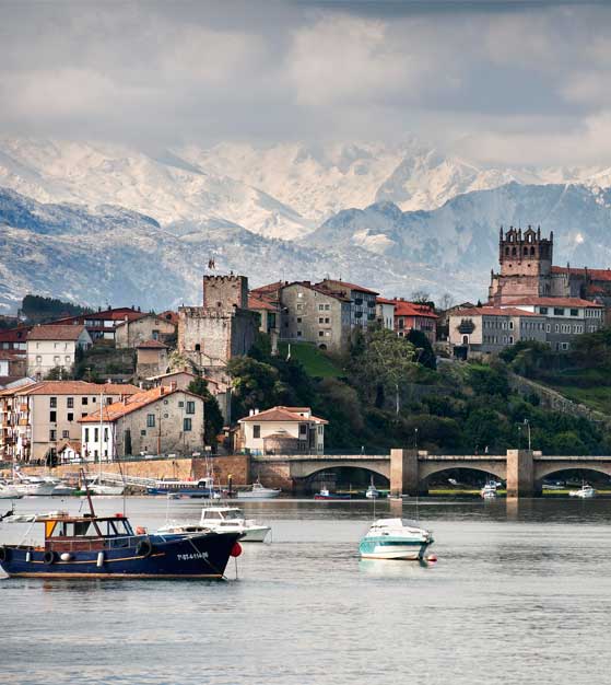
Fishing village in the westernmost part of Cantabria befote our route heads into Asturias. One time Roman port of Verasueca, and previously inhabited by a Cantabrian tribe, the village later became an important whaling and shipbuilding centre. It is now a modest fishing port and tourist centre. Until 2001 all north coast traffic was obliged to pass through the narrow street which crosses the centre of the village. The construction of a new motorway bypass means that San Vicente de la Barquera will enjoy a more peaceful atmosphere.
Visit
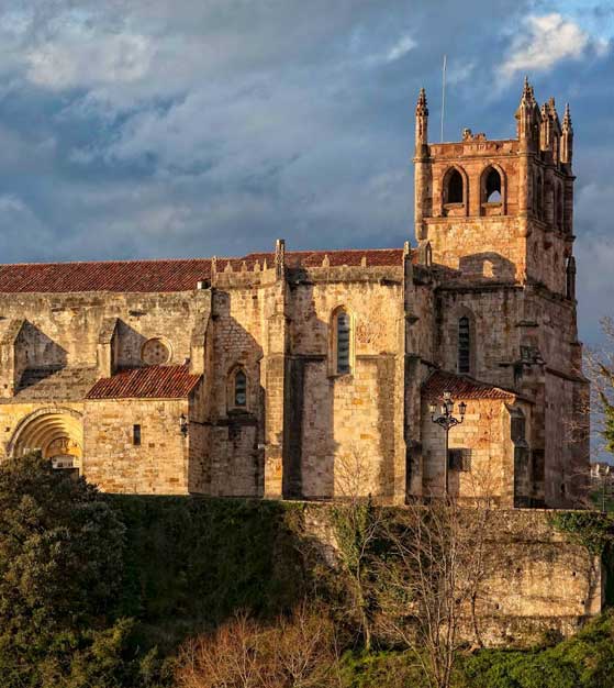
San Vicente de la Barquera is built on a promontory that is linked to the mainland by two bridges. The Puente de la Maza is the bridge that takes us into San Vicente as we approach from the east. It has 32 arches and was started in the 15th century ( being built over the original wooden bridge ), although it was later modified. The second bridge, the Puente Nuevo or Puente del Parral leads to the fishing wharf and is also our exit to Unquera and Asturias or the Picos de Europa. The village was one of the 4 inportant maritime villages of Cantabria and was also an important watering place on the nothern route to Santiago de Compostela. The remains of the old pilgrims hostel can still be seen in the Old Quarter. The medieval village conserves the remains of the 15th century castle, the Puerta de Poniente ( the gateway) and also the gothic church – the Iglesia de Santa María de los Ángeles which was mainly built in the 13th century ( over the remains of a previous church) and then modified in the 16th . Its imposing tower was added in the 19th century. Inside the church there is a statue of the Inquisitor Antonio del Corro, which is considered one of the best examples of the Renaissance funerary art in Spain. Del Corro died in 1556 at the age of 84. The inquisitor lies peacefully reading on his own tomb.
Outside the church we can enjoy a walk around the old town wall above the tidal flats and the clam farms in the estuary below. These walls originally date from the 8th century although they have of course been modified, and protected the village from Viking and Norman attacks. Some of the original gateways can still be seen such as the Torre del Preboste ( where taxes were levied in medieval times – it later became a prison) which gives access to the Reinaissance Palacio del Corro which is now the Town Hall. Nearby, between the Town Hall and the church, is the Hospital de la Concepción dating from 14th – 16th centuries which gave shelter to the pilgrims to Santiago de Compostela. A little further down the hill is the castle – El Castillo del Rey which dates from 1210 ( although its origins would of course go back much further) is open to the public and houses an exhibition of the history of the village.
The square in the centre of the village waswas once the fishermen´s quarter. Between this square and the bridge Puente Nuevo we can find many restaurants specialising in fish and seafood platters. Crossing the bridge and taking the turning to the right we find the present day fishing wharf. Following this road by the sea we reach the Ermita de la Virgen de la Barquera which dates from the 13th century. This picturesque chapel is where the Virgin Mary is said to have appeared on a boat without oars or crew. This is why San Vicente is de la Barquera. La Barquera refers to the Virgin of the boat. Her appearance is celebrated every year just after Easter in the Fiesta de la Folía where a reproduction of the virgin is paraded through the streets and then on the water onboard one of the village´s fishing boats.
COMILLAS
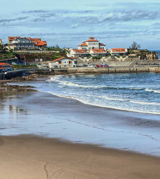
Comillas is a unique mixture of rural village, fishing harbour and aristocratic buildings, all of which confer a special character. It produced 5 bishops during the 17th and 18th centuries and is thus known as the “ village of the bishops”. Our entrance to Comillas takes us along the beach, past the small harbour ( the last whaling port of Cantabria) and to the crossroads in the centre of the village which enables us to get an idea of the topography of Comillas. From the crossroads we can easily reach sights such as the elegant main square and the “ Capricho” of Gaudí.
Many of the buildings were erected following orders of Don Antonio López y López,the first Marquis of Comillas- an Indiano who, after having made his fortune in Cuba, returned to his hometown and was made Marquis by King Alfonso XII. Some say that he was a slave trader. López was born in 1817 and spent his humble infancy in Comillas.López`s Compañia Transatlántica was one of the main supports of Alfonso who granted López his noble title. Comillas is now an important tourist centre and is associated with the aristocracy after the visit of Alfonso XII and his court in 1881. Until that time it had been just a humble fishing village, founded by fishermen of San Vicente de la Barquera who lost their homes in a fire and decided to continue fishing for seabream and whales from Comillas. Alfonso´s visits made Comillas fashionable and brought electricity to the village and also the Catalonian Modernist influence.
The most important sights are:
El Palacio de Sobrellano – a fine building built by the Catalonian architect Doménech i Muntaner.The neighbouring chapel / family mausoleum forms part of the architectural whole. The chapel was actually designed as Both buildings date from 1881 when they were commissioned by the Marquis. The architect also designed the Fuente de Tres Caños.
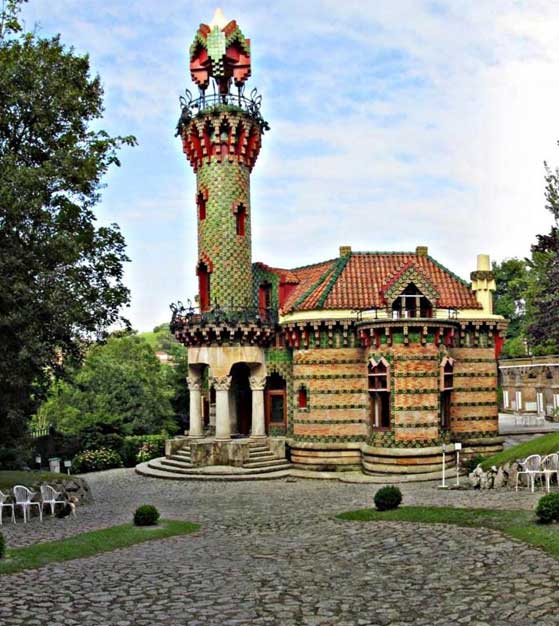
El Capricho de Gaudí – a small building but probably the most famous in Comillas by the Catalonian architect Antonio Gaudí, author of the famous Sagrada Familia cathedral in Barcelona. Capricho means whim or fancy.It was constructed in 1885 and is now a restaurant. The exterior is coverd by ceramic tiles with arabesque motifs
The Cementery of san Cristobal – crowned by the exterminating angel of the sculptor Josep Llimona that dominates the ruins of the old gothic monastery. The cementery was remodelled in the Modernist style by Doménechi Montaner.
Monument to the Marquis de Comillas – erected in 1890 by Doménech i Montaner as a tribute to the Marquis.
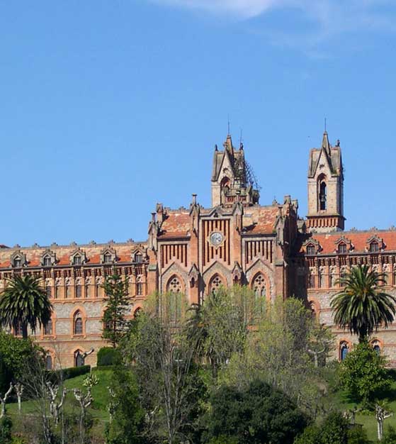
The Universidad Pontificia – the Papal University dominates the whole village and was built in 1883 by the architects Martorell, Cascante and Domenech. Gothic-Mudéjar style. The University is now destined to become a Spanish language school for foreign students.
Apart from these sights, it is also worth visiting the squares around the parish church in the centre of the village with their outdoor pavement cafés and restaurants. These squares contain examples of medieval regional architecture. Comillas also has a small fishing harbour.
POTES
Potes is the principal centre of the eastern side of the Picos de Europa. It lies strategically at the meeting point of the four valleys ( Valdebaró, Valdeprado, Cereceda and Cillorigo) that make up this area known as Liébana. It is said that the name of the village is derived from the Spanish for bridges – puentes.Potes has been the “ capital of this area known as Liébana since the Middle Ages. It has a small population but it is popular with tourists, walkers and mountaineers which give it a lively atmosphere.
Every Monday morning a market is held in the village. It has its own particular microclimate due to the distance from the coast and the fact that it is completely surrounded by mountains which shelter it from the wetter coastal weather. You willnotice that the vegetation and agriculture of the lower valleys is somewhat different from the coast.
The most impressive sight in Potes is the XV century fortified tower, The Torre del Infantado in the centre of the village. This symbolises the power of the family of the Marquis of Santillana. It now houses the town hall.
The Old Quarter of the village suffered greatly during the Spanish Civil War. However, it is still worth visiting to see the medieval buildings decorated with coats of arms and to enjoy the bustling atmosphere. The two sections of the old quarter are linked by the bridge of San Cayetano, with the adjacent chapel of the same name.
he area is well known in Spain for its production of blue cheeses such as picón, tresviso, cabrales and also for many other types of cheese. These can be seen in the outdoor market held every Monday since 1921. Typical is thecocido lebaniego,a mixture of soup, meats and sausages and chick peas – a meal in itself. From the pressed grapes a spirit is distilled which is called orujo . This is also available in sweeter versions where it is mixed with honey or herbs. It is also mixed with a sort of camomile tea called té del puerto, which you may like to try after eating.
The town is built around the main square, which is dominated by a large fortified tower – the Torre del Infantado – a 15th century construction that now houses the Town Hall.
In the area behind the church we find the church of San Vicente ( 14th – 17th century)
CUEVAS DE ALTAMIRA
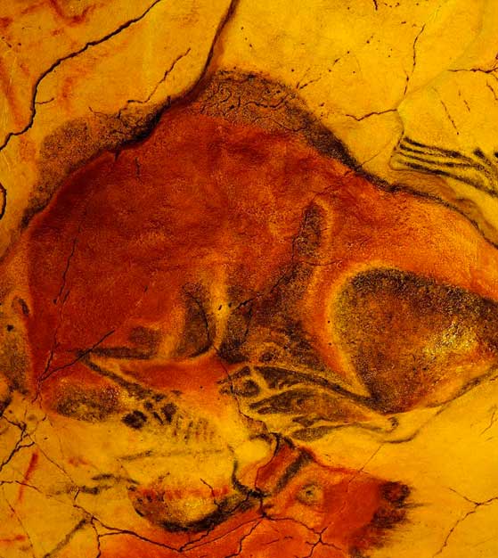
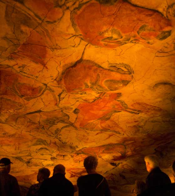
Santillana del Mar is also home to some of the finest cave paintings in the world, those of the Caves of Altamira. These are some of the most important cave paintings in Europe along with those of Lascaux, France. They go back over 16,000 years.
The paintings were originally discovered by Marcelino Sanz de Sautuola and his daughter in 1876. Whilst he was exploring the cave, his daughter saw the paintings on the cave roof and exclaimed “ Look father¡ Bison “ The discovery was greeted by the disbelief of Sautuola´s contemporaries who claimed this was a hoax; it was hard to believe that primitive man was capable of such sophisticated art. Finally, two decades later the authenticity of the paintings was accepted.
The cave became a major tourist attraction and was declared a National Monument in 1924. The great affluence of visitors altered the climatic conditions of the cave and the paintings began to deteriorate. Entrance was limited in 1977 ( the waiting list then became years long) and the caves were finally closed to the public in 2001.
However, an impressive new museum has been built which houses a replica of the cave and is well worth a visit as it really does give the impression of being inside the cave itself and has a series of didactic and high technology aids which include hologram reproductions of the cave dwellers.In a rather paradoxical way, the Neocueva actually improves on the original cave. Access to the latter was little more than a hole in the hillside barred by an iron door.This was due to the fact that the original cave entrance had collapsed thus sealing and preserving the cave for so many centuries. The new museum has actually reconstructed the whole cave mouth so we can gain an accurate impression of what the cave was like when it was actually inhabited. The visitor is now able to see the living quarters at the mouth of the cave and penetrate the cavern to reach the chamber of the paintings. It is hard to belive that this is an artificial recreation.The paintings and the cracks in the stone have been painstaklingly recreated so that even the guides of the original cave are unable to distinguish the two.
The painting chamber is often referred to as the “ Sistine Chapel of rupestrian art”; Picasso himself said that “ none of us able to paint in that way”. The boldness and artictic quality of the paintings is outstanding. There are 27 bison, 2 horses and various deer. These bison are often used as a symbol of the area of Cantabria. Indeed, Cantabria and Asturias have many different caves, often with caves paintings and other remains. Others such as El Soplao have spectacular formations. The Museum of Altamira also houses a permanent exhibition of artefacts from these local caves and gives a fascinating insight into the lives of the inhabitants. It is surprising when we consider just how sophisticated their culture indeed was as we see musical instruments, sewing implements and other objects. Indeed, the museum compares their culture and lifestyle to that of North American Indians and Eskimos in the relatively recent past.
PARQUE DE LA NATURALEZA CABÁRCENO
The cabarceno natural park is not a conventional zoo or a wildlife park. It is a naturalized space by the hand of man, from the primitive beauty of the karst landscape on the 750 ha of a former opencast mining.
SANTILLANA DEL MAR
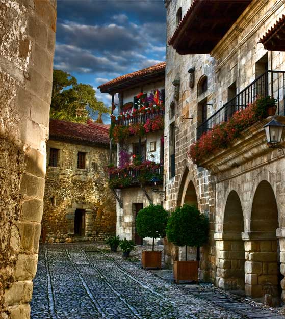
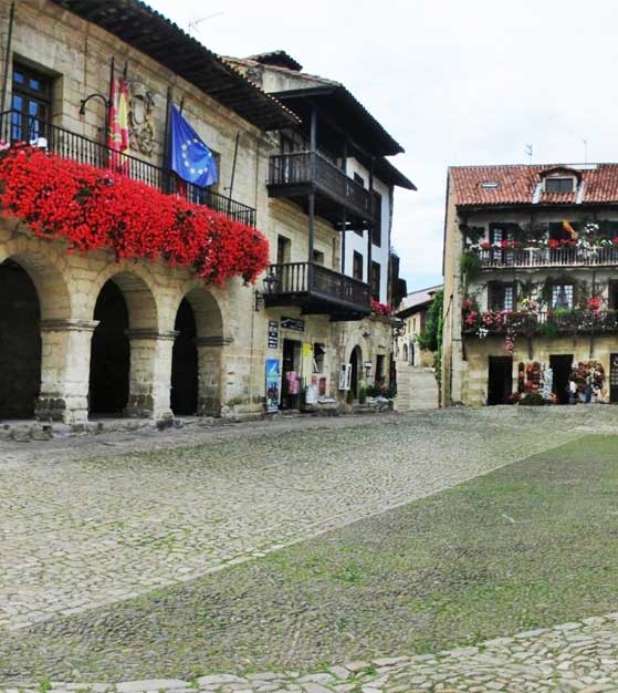
Santillana del Mar is probable the most archetypal of the villages of this particular region of Spain, a source of pride for the inhabitants of the region.Described by Jean Paul Sartre as “ the most beautifu lvillage in Spain”.It is both a medieval town with grand palaces and at the same time a simple dairy farming village of just over 4000 inhabitants. Itshouses are decorated with coats arms, indicative of its glorious past. Its wealth in medieval times came from wool and linen. Now tourism forms one of the most important sources of income, if not the most important as the proliferation of hotels, guest houses and souvenir shops shows.
Santillana del Mar in Spain is known as” the village of the three lies”. In Spanish santa means holy, llana means flatand mar means sea. The locals say it is neither holy nor flat and the sea is a couple of miles away¡ The name is derived from Santa Juliana, an Anatolian martyr whose remains have lain here since the 6th century. The monastery of Santa Juliana and the origin of the medieval settlement was created in 870 AD. During the Middle Ages , the village was more important then the neighbouring Santander. The 14th and 15th centuries saw a period of decadence market by fighting between nobles.
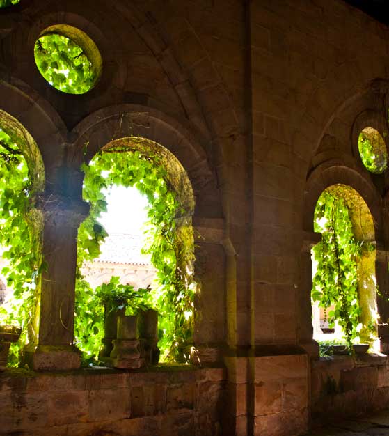
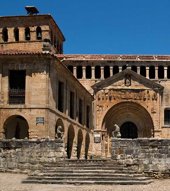
The village would only recover due to the wealth brought back by the indianos the emigrants who left for the Americas and brought back their riches to their native land later in life. The construction of the Dominican Convent of Regina Coeli gave the village considerable cultural importance. In 1889 the village was declared Monumento Histórico-Artíctico and thus benefited from a greater degree of protection, which has meant we can see it almost exactly as it was centuries ago. The church, La Colegiata de Santa Juliana, is one of the most outstanding examples of Romanesque architecture in the region. The altar is made from Mexican silver, brought back by those who sought their fortune in the Americas. The cloister is well worth a visit; although visiting hours are restricted.
Visit
The street plan has remained virtually unaltered since the 16th century and forms a “Y”
shape with the two streets.The street of Juan Infante takes us to the Market Square( or Ramón Pelayo Square) where the Town hall and the Parador are situated. The other, the Calle del Cantón, takes us to the splendid Colegiata from where our visit begins.
The Colegiata is a beautiful Romanesque church, which was begun in the 12th century (built over the remains of an earlier 10th century Benedictine monastery dedicated to the Saint Juliana) and has undergone numerous modifications . It is also dedicated to the Saint Juliana de Bitinia, whose husband Eulogio had put to death for her refusal to giver up her virginity and her faith in God during the persecution of Christians by the Roman emperor Diocletioan in the 3rd century AD . It soon became the biggest medieval monastery in Cantabria reaching its greatest economic and jurisdictional importance in the 12th century . The affluence of Pilgrims on their way to Santiago increased its importance. The front doorway with the figure of Santa Juliana was added in the 17th century. To the right of the gateway, we can see the original round tower , which was the bell tower of the first church. Round the left hand side of the church is the fine cloister dating back to the 12th / 13th centuries ( ticket required)
From here we continue along the street past the Casa de los Villa( or Casa de los Hombrones- House of the Big Men- so called because of the two warriors which are depicted on the coat of arms. We immediately reach the Casa de Leonor de la Vega,mother of the first Marquis of Santillana; this 15th century construction is now a luxury hotel. Further along the street are the Casa-Torre de los Velarde, tha Casa de los Bustamante, the Casa de Barreda but first we turn right down the Calle de las Lindas which will take us to the main square. As we reach the square, we find the 15th century Torre de Don Borja where many exhibitions are held by the Fundación Santillana; The house joined to the right of the tower is a later addition. The other fortified tower in the square is the Torre del Merino, symbol of the lordly power which was to challenge the ecclesiastical power from the 14th century onwards as representative of civil authority and the fiscal rights of the monarchy. This was the residence of the representative of the king and its purpose was primarily military. The original structure is conserved inside. Exibitions are also held here.
On the other side of the square the Town Hall and the Casa del Aguila and the Casa de la Parra. Opposite these is the Palacio de los barreda, site of the Parador Gil Blas. As we leave the square and continue along the street we can see the Palacio del Marqués de Benamejís. Crossing the main road, we reach the Convento Regina Coeli( a convent of Clarisan nuns) home of the Museo Diocesano which houses a collection of religious art, founded in 1969. Nearby are the Convento de San Ildefonso (1667) and the Casona de los Tagle which has a fine coat of arms and houses a museum.
SANTANDER
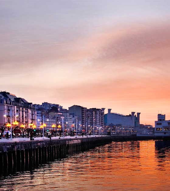
Santander is the capital of the province of Cantabria and has a population of about 200,000. The city has an incomparable position on the shores of a huge bay. Due to its position on the southern slope of a peninsula, it actually faces south, something rather unusual for a city on the northern coast of Spain.
On the whole, Santander is a modern city with very few buildings that go back beyond the 19thcentury. A huge fire ravaged the centre in 1942 meaning that a lot of buildings were then irretrievably lost and the city had to be rebuilt. The main shopping area is around the Town Hall and if you want to take a stroll around thetapas,bars and pubs then the area behind the Banco de Santander and betwwen the Bank and Puerto Chico is the place to go from about 9 p.m. onwards. This is the area known as Cañadío with the square – Plaza de Cañadío – as its neuralgic centre.
The history of the area is first reflected in the prehistoric remains that are to be found nearby in caves around the bay. In the year 21 BC the Roman emperor Augustus Caesar sent his navy to subdue the local tribes known as the Cántabros. Santander with its natural port became the logistical operations centre and was known then as Portus Victoriae. In the crypt of the Cathedral it is possible to see Roman remains.
The name of the city is derived fron the martyr Sancti Emeteri. It is said that the heads of the martyrs San Emeterio and San Celedonio arrived in a boat made of stone which created a hole in the small island known as La Horadada – the hollwed rock – which is visible in the vivinity of the Isla de la Torre and the Península de la Magdalena.
In the Middle Ages the city became important due to the exportation of Castillian wool to Flanders and Amtwerp. Successive plagues ravished the city and caused a decline in its fortunes.In the 18th century the port regained importance due to trade with the Americas. In 1755 Fernando VI granted the title of “city” and in 1817 it became the capital of the province. The dispute over the bishopric was resolved in favour of Santander and the Colegiata of Santander became the present day cathedral. The liberalisation of trade with the Americas in the 19th century strengthened the city´s position still further and brought extensions to the port facilities and shipyards along with the emigration of local inhabitants – the indianos – across the Atlantic.
In 1893 the explosionof the cargo ship the Cabo Machichaco caused over 500 deaths. In 1941 the old town of Santander was unfortunately destroyed in a huge fire which explains the relatively modern appearence of the city today.
Santander is now an important administrative, commercial and touristic city. In summer it celebrates a week of bullfights in honour of Santiago Apóstol ( 25th July ) and the Festival Internacional de Santander in which artists of internacional renown participate – mainly in the field of classical music and dance.
The Museo de Bellas Artes, the art gallery, is to be found in the centre of the city. It houses works of art from the 15th century to the present day, the most important being the protrait of Fernando VII painted by Goya in 1814. The Cathedral dates back to the 13th and 14th centuries, although it had to be rebuilt after the terrible fire of 1941. Roman remains can be seen in the crypt. Opposite the Cathedral is the square known as the Plaza Porticada, built after the fire of Santander to house local government offices.
The main building is now occupied by the Caja de Ahorros, the savings bank of Cantabria. This square was where the Santander Summer Festival of Classical Music and Dance was held from 1948 until the Palacio de festivales was built. Huge canopies were erected over the seating and traffic was diverted around the square.
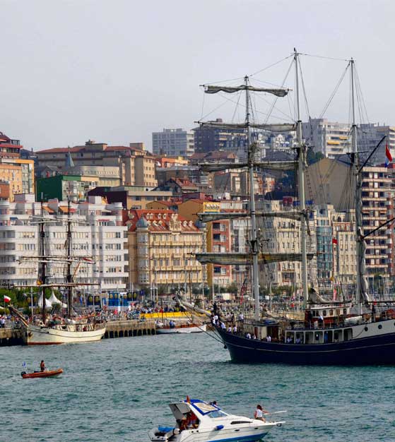
The boat fron Somo and Pedreña arrives at the Embarcadero ( wharf ) in front of the Paseo de Pereda. A goods trainline ran along here from the stations to Puerto Chico and was still in use during the 1980s. Now an extensive promenade has been made, complete with cyclepath. The pavilion situated where the Somo boat land was the old customs house and is now an exhibition center. Further along the promenade towards Puerto Chico we see some attractive statues dedicated to the raqueros (scallyway or scoundrel). These children use to dive into the water to retrieve coins thrown to them by passers by.
The avenue along the waterfront between the harbour of Puerto Chico and the cathedral is known as the Paseo de Pereda.This is a row of fine buildings and would have been the previous center of trade of the city, combining fine appartments and shhipping offices / warehouses ocupied by the local tradesmen. In the center is the fine archway of the Banco de Santander, once a hotel. The building is 19th century and was bought by the bank for its headquarters in the 1950s, wich is when the central arch and the building to the left of the arch was added.
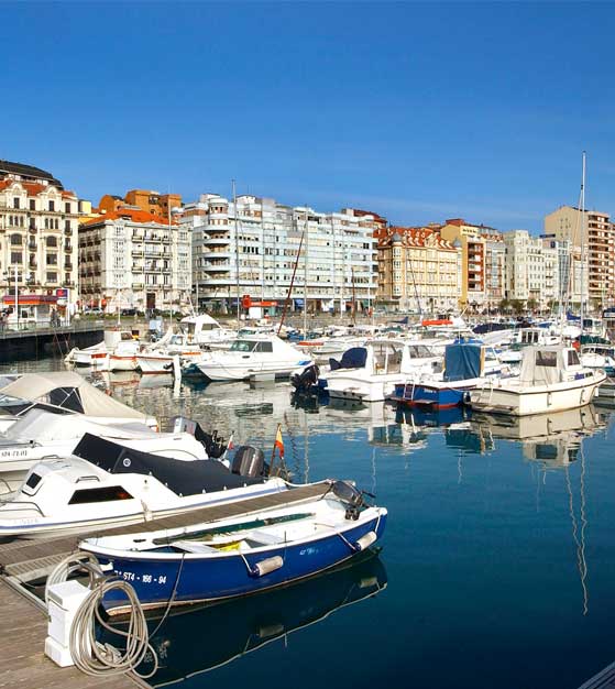
Puerto Chico is the harbour al the end of the Pase de Pereda. Originally it was the fishing harbour; this was moved farther along the bay in the mid 20th century and Puerto Chico became a pleasure boat harbour. This fishing boats now dock further along the bay in the Barrio Pesquero, not particulary attractive harbour but with a selection of fish and seafood restaurants full of loca flavour.
The huge rectangular marble building at the end of Puerto Chico is the Palacio de Festivales, host to the Santander Summer Festival and other artistic even throughout the year. The building itself was rather controversial.
Beyond the Palacio de Festivales, aproaching the Playa de la Magdalena is the Museo Marítimo del Cantábrico.This museum cobres all aspects of the relation of the local populations with the sea, including large aquariums where the local marine fauna can be observed. The museum also has a good restaurant with a very reasonable menu of the day and fine views over the Bay of Santander.
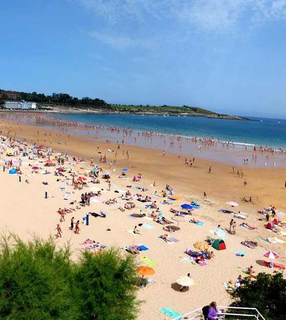
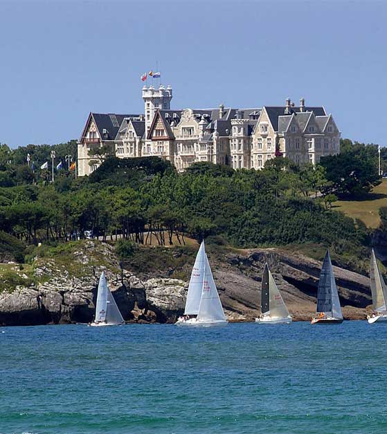
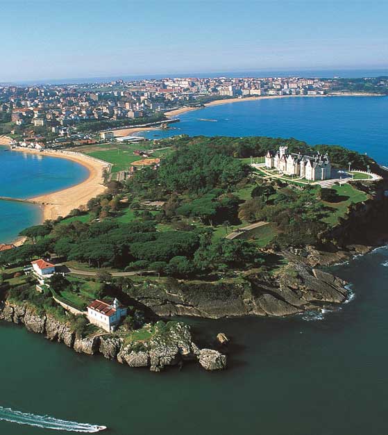
Leaving the centre of the city and following the waterfront towards the entrance to the Bay, we reach the residential and tourist area of El Sardinero (whose name derives from the sardines caught opposite it extensive beach). This is an area with fine coastline and elegant buildingssucha as the Palacio de la Magdalena, the Casino, and the Hotel Real. The acces road to the Sardinero (Avenida de Reina Victoria) is lined with ellegant villas used by the aristocracy and civil servants accompaning the king. El Sardinero became important due to the summer visits of the king Alfonso XII and his queen Victoria Eugenia at the beginning of the 20th century when bathing in the sea became fashionable. At the time, the king used to spend the hot months of summer in nearby San Sebastian although he usually found time to visit Santander. The city of Santander then decided to concede the Península de la Magdalena to the royal familyand the Palacio de la Magdalena was built by the architects Bringas and Riancho and given to the king in 1912 as a wedding present.Thus the royal family came to spend their summers in Santander along with other members of the court who considered the city the place to be in summer. The area of El Sardinero saw the construction of new and elegant villas such as Villa Piquío, Villa Rita and Villa Hope. In 1917 the Hotel Real was opened and in 1916 the reformed Gran Casino. At the same time the city gained the hippodrome of Bella Vista, the Teatro Pereda, the polo field of La Magdalena, the Club Marítimo and the Real Golf course in Pedreña. Luxury yachts were anchored in the Bay and were the scene of parties. The navy also visited and of course the social and cultural life of the city was increased with bullfghts, opera, concerts etc. Which have in a way lasted to the present day although the royal visits have of course ceased. The Palacio de la Magdalena and the Península now belong to the City of Santander and are a fine place to walk and enjoy the magnificent views. Originally the Península was home to the chapel of Santa Magdalena and a defensive castle due to its strategic position at the mouth of the Bay of Santander. It was covered in holm oaks and nowhas pine woods, sent by Alfonso XIII from his palace of El Pardo in Madrid. The Palace is now used for activities of the Universidad Internacional Menéndez Pelayo ( UIMP ), which organises summer academic courses and encounters of all shapes and sizes along with a popular summer Spanish language school.
The three galleons displayed on the Península were built by Vital Alsar in 1977 to cross the Atlantic. They are a replica of those used by Orellana to discover the Amazon. Alsar later donated them to the City of Santander.
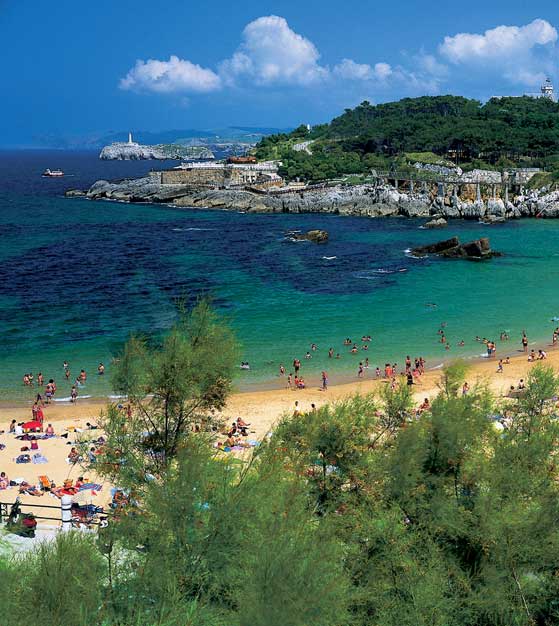
Beyond to the Sardinero, lies the headland known as Cabo Menor. This is a fine walk which has marvellous views of the city and the surrounding coastline and mountains. Skirting the golf course on Cabo Menor, we reach the beautiful cove of Mataleñas with its fine beach. After Mataleñas we continue towards the lighthouse past old defense posts dating from the civil war. Finally we reach the cape and lighthouse of Cabo Mayor with its monument to the fallen in the Spanish Civil War of 1936-39. It is said that prisioners were thrown from the cliffs here during the war.
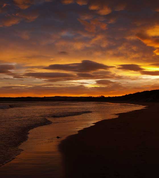
SOMO Y BAHÍA DE SANTANDER
In comparison with other villages, Somo os of fairly modern construction.
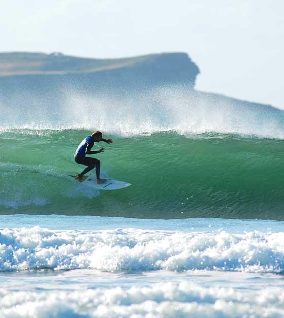
The village lies on the impressive beach, whichi stretches from El Puntal ( just a stone´s throw away from Santander across the entrance to the Bay) right the way along to Loredo. The beach has a backdrop of fine dunes and is excellent for walking and enjoying the sea views. Currents here can be very strong so be careful when bathing. A horse race called the Derby is held here every summer. The beach is also popular with surfers and Somo itself has some surf schools and a surf centre where equipment can be hired.
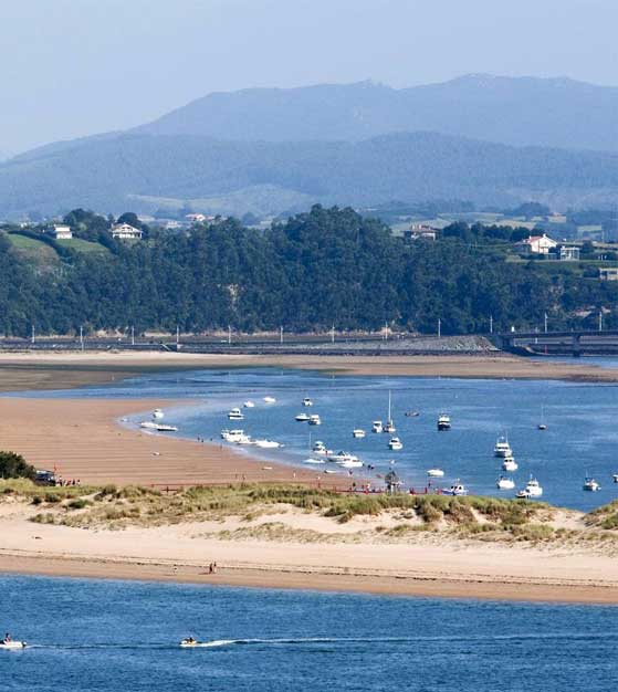
On the other side of the village is the estuary known as the Río Cubas, which is actually where the River Miera meets the Bay of Santander. From this side of the village it is possible to take a boat trip across the Bay to the capital of Cantabria, Santander. This is one of the advantages of Somo – in addition to its beautiful nearby beaches and unspoilt countryside, it is only a 15 minute trip away from Santander with its restaurants, beaches, shops etc.
Crossing the bridge over the Río Cubas we reach the golf course called the Real Club de Golf de Pedreña, created in 1928 and considered to be one of the most beautiful in Spain. A little further along the road we reach the village of Pedreña which has a ouple of fish restaurants on the left just by the waterfront that barbecue sardines outside and are good choice if you enjoy fish. Pedreña is famous for its clams collected from the Bay of Santander at low tide. It is also famous for being the birthplace and golfing school of Severiano Ballesteros who has a house by the golf course and can be seen around the villages of Pedreña and Somo.
In and around Somo we find two ceramic workshops where artists sell their own creations in contrast to the mass-produced ceramic ware.
If we head a short distance east from Somo, we reach the beautiful beaches of Langre and Galizano. Langre is one of the most beautiful in the province, surrounded by fine cliffs where the strata are clearly visible, and green meadows. Take care when bathing due to the currents. Roudn the corner is the beach of Galizano, again very picturesque and also shaped by the tiny river which flows into the sea here. The beach itself is virtually an estuary where the tide comes in a great distance between the green meadows, and is ideal for bathing. Both are certainly worth a visit from Somo.
Santander lies on the shores of an extensive Bay, the Bay of Santander. Strangely enough, the city itself actually faces south, even though it is on the north coast of Spain.
This is due to the fact that it has grown on the southern slope of a peninsula, which encloses the bay, thus giving rise to this privileged and sheltered position. The best views of the Bay are to be seen from the city of Santander, rigth along to the Magdalena Península. Looking south, we see the village of Pedreña y Somo, and beyond Peña Cabarga, crowned by its TV aerial, and the backdrop of the Cantabrian Mountains with the province of Burgos visible in the distance. It also has its own beaches, the most picturesque being those which lead to the Palace of the Magdalena. Opposite is the long sand spit of El Puntal, almost closing the Bay. This beach has the advantage of having two sides, one sheltered on the Bay, and the other on the open sea. This beach extends down to Somo and on to Loredo, ending at the island of Santa Marina, once sit of a monastery. The area between the Puntal itself and Somo is often used by nudist beachgoers. The bay itself has been slowly reduced over the centuries as the sourrounding inhabitants have slowly reclaimed land from the sea. Thus large parts of the city of Santander and particularly the industrial areas the docks and the airport are built on what was once water…
